By Steve Kramer

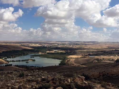
ALFE MENASHE, Israel — The ESRA Hiking Club (esra.org.il) ventured south to the hills of the northern Negev recently for one of the most beautiful hikes that I’ve done in Israel. We were heading towards the Yeruham Park and Lake, where there are green groves and a manmade lake in the middle of the desert. After years of neglect, a sewage recycling plant was finally constructed on the outskirts of Yeruham by KKL/JNF (Jewish National Fund), helping to revive the lake and make this park an unexpected pleasure.
As we passed “unrecognized” Beduin encampments with no infrastructure, Reuven explained that the Beduin problem has not yet been resolved. He believes the Beduin are winning, because many of their primitive encampments have been legalized, despite the State of Israel policy of building large towns with modern amenities for the Beduin to inhabit. The organization regavim.org leads the fight against the Beduin land grabs in the Negev. The Beduin are supported by the EU, individual European states, and numerous anti-Zionist non-governmental organizations (NGOs).

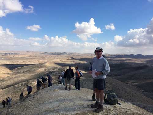
The weather was perfect for hiking. As we progressed through the relatively barren desert landscape, we were on the lookout for winter flowers, signs of animal life, and beautiful views. Eventually we reached a viewpoint from where we could see the lake, with the desert town of Yeruham beyond it. On the far side of the town is located the Great Machtesh (crater), one of the Negev’s major attractions. We could just make out the location of the crater’s edge.
Yeruham is the site of Tel Rahma, dating back to the 10th century BCE. On the outskirts of Yeruham is an ancient well, Be’er Rahma, which some archeologists believe is the well where Hagar drew water for her son Ishmael. In 1951, the town was founded as a “development town,” where new immigrants from Romania, North Africa, Iran, India and other non-Western countries were placed. A sea-change for Yeruham occurred when the former mayor of Haifa, Amram Mitzna, a reserve IDF general, served a 5-year term as mayor. Since then, the town has experienced revitalization and now has a population of 10,000. It is benefiting from the general growth in the Negev and its location just a half-hour’s drive from Beersheba.
At this point in our hike we circled to the right of the park, first descending and then beginning a series of long climbs up to another summit, from which we could see a second desert town, Dimona. The 360 degree panorama from the summit was fabulous. We were rewarded on the trail with several viewings of nearly-hidden yellow crocuses, one of four varieties of the flower, which only grow in several, choice spots in the region. This particular variety is called the Helmonit crocus, deriving from the Hebrew for egg yolk. These varieties were thought to be extinct, but are now recognized as endangered.
Soon we began our decline towards the park. When we eventually reached it, Reuven pointed out the tamarisk trees which had encroached on the perimeter of the lake, similar to what one sees at Lake Kinneret (Sea of Galilee). He explained that since the lake was revived by a new sewage plant, it became suitable for introducing fish and recreational fishing.
We soon returned to our bus for the ride north. Of course, we made the obligatory stop for coffee at a cafe along the road. Besides enjoying the exercise and the magnificent views, we had learned that the Negev is becoming something more than a large training area for the IDF. Now it is a significant factor in modern Israel, with the government, the IDF, the local communities, the KKL/JNF and the environmental NGOs driving its growth.
*
Kramer is a freelance writer based in Alfe Menashe, Israel. He may be contacted via steve.kramer@sdjewishworld.com. Any comments in the space below should include the writer’s full name and city and state of residence, or city and country for non-U.S. residents.